GIS Maps
GIS Maps
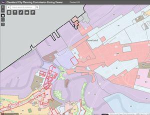
The Cleveland City Planning Commission provides the public with an interactive GIS web app for viewing the official zoning district maps, overlays, landmarks, and other planning-related information in the City of Cleveland. Users can select layers of interest and customize the web app as needed. Widgets allow users to search addresses, select parcels, print, share maps, measure, filter and more.
By default, the CPC Zoning Viewer is configured with a standard set of layers for common zoning information.
We also provide the following preset configurations of the CPC Zoning Viewer that load the layers pertinent to other common tasks. Please see our gallery of alternative CPC Zoning Viewers below. Please note that users may still fully customize any of the following web apps after opening.
Interactive GIS Viewer
You can now view all of City Planning's data, web maps, and research at the City's Open Data Portal at data.clevelandohio.gov. Explore datasets and tools from various City departments, such as official boundaries, permitting, demographics, and more.
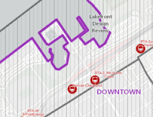
Design Review & Local Landmarks Districts
To look up which design review district and region a site falls under, and who to contact. The historic districts/parcels take precedence over design review districts.
Local and National Landmark Districts
To look up City of Cleveland local landmark districts, parcels, and points. For additional historical context, historic fire insurance and plat maps (via Cleveland Public Library) can be enabled in the layer control.
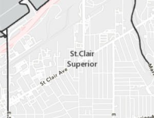
Neighborhood & SPA's
To browse Cleveland's various neighborhoods, which are formally known as Statistical Planning Areas (SPA). The last time SPAs were modified was 2012.
Residential Facilities
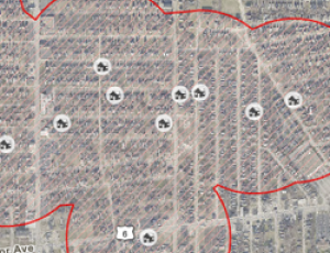
To view all residential facilities licensed with the Ohio Department of Mental Health and Addiction Services, including the City's regulatory 1,000 ft buffer zones between all facilities.
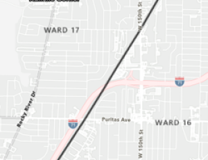
City Wards
To explore the City's seventeen wards, find your Councilmember, and have quick access to their contact page at the Cleveland City Council website.
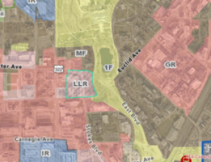
Zoning Viewer
This is the standard zoning viewer for exploring basic zoning information in the City of Cleveland. It includes zoning districts (use, height, area) and overlay districts. Additional zoning information can be found in the layer control.